4 feet 2 mouths

walking and eating our way around the world

Archive for the tag “Nature”

Falling for Fall in the Hudson Valley (by Carmen)

Fall foliage in the Hudson Valley

Fall foliage in the Hudson Valley

Towards the end of October Nathan and I celebrated a big anniversary so I wanted to surprise him with something different than our usual nice dinner out. Instead, I developed a secret day trip to the Hudson Valley. To make it extra special, I organized our adventure around three common interests: culture, food and nature.

Path to the Chuang Yen Monastery temple

Path to the Chuang Yen Monastery temple

Buddha in the Hudson

Buddha in the Hudson

Nathan had his suspicions and was able to guess some of the day’s activities, but I really threw him off when I pulled into the Chuang Yen Monastery grounds. This was a serendipitous online discovery. The Hudson is known for artist colonies and high end antiquing more than Chinese monasteries so when I saw the name displayed on Google map I had to learn more. Not only does it have the largest Buddha statue in the Western hemisphere, it also serves a vegetarian lunch to visitors on the weekends. I knew I made the right decision as we walked into the dining hall. Plates were piled high with stir fried vegetables, stewed seitan, braised tofu, rice and chili sauce. It was as delicious as I’d hoped. The two women next to us were discussing Buddhist philosophy as well as a recent group of monastery visitors from Tibet. Based on our experience in Dali in 2012, we made sure to finish every single speck of food on our plate, down to the last grain of rice.

Lake with goddess statue

Lake with goddess statue

Japanese maple tree

Japanese maple tree

After lunch we walked around the grounds, which included a small lake and a mausoleum. The lunch, peaceful surrounds and chill in the air brought back so many memories of our time in China. Especially our trek between the monasteries of Mount Emei Shan.

Fishkill Farms barn, orchards and vegetables

Fishkill Farms barn, orchards and vegetables

Trees laden with apples made for easy picking

Trees laden with apples made for easy picking

Apples!

Apples!

We left the monastery and headed north to Fishkill Farms. What Nathan did guess right about the surprise day trip was the “food” portion of the day: apple picking! Some apple farms that let you pick your own fruit (known as PYO) are like amusement parks focused more on hayrides and corn mazes than produce. I wanted to avoid that scene and, while there were plenty of people at Fishkill Farms, there were quiet corners in the orchards and vegetable patches. The tree limbs were heavy with crisp, ripe Golden Delicious apples, the kale was in full bloom, and we walked out with our arms full of goodies.

Nathan practicing his expert juggling skill

Nathan practicing his expert juggling skill

Apple cider donuts

Apple cider donuts

Most people at the farm seemed to congregate around the apple cider donut stand. Nathan and I had heard people talk of these sweets but we weren’t sure if they were really worth the hype. As we stepped up to the counter, we could smell the fresh from the fryer donuts. Still piping hot, they were coated in cinnamon sugar that became slightly caramelized and crackly. We took our first bite and it was a revelation. Yes, apple cider donuts really are that good. Looking forward to many more of these in my life.

“Jade Rock of Hope and Prosperity”

“Jade Rock of Hope and Prosperity”

One last surprise, was to take a little walk on the Appalachian Trail to honor both our love of nature and of long-distance trekking. We pulled into Fahnestock Park and immediately saw a beautiful green rock jutting out from Canopus Lake. I think we were influenced by our monastery visit earlier in the day but again we were reminded of views from China. We therefore decided to name it the Jade Rock of Hope and Prosperity.

Now that I’ve seen the Hudson Valley in the fall and winter, I’m thinking spring and summer trips are in order!

Hurting for a Yurting (by Carmen)

It was still a cold, blustery spring when our friend Taylor suggested a summer camping trip. As extra enticement, the campsite she had in mind came equipped with the most fun to say accommodation on earth – a yurt. The heat of summer was still just a glimmer in our eyes but we could already taste the campfire s’mores. We replied with an enthusiastic yes.

Yurt sweet yurt

Yurt sweet yurt

It was months later, in the dog days of summer that Taylor, Andrew, Nathan and I piled into our rental car for the drive to the Belleplain Forest in New Jersey. But NJ didn’t want us. Or so it seemed from the massive effort it took to get into and through the Holland Tunnel. When we finally emerged on the other side we all felt extraordinarily grateful for leading car-free lifestyles exempt from the daily traffic grind. We still had a ways to go since our destination was in the southern end of the state. We passed the time with upbeat music, good conversation and entertaining roadsigns, like the community of Cheesequake. I think NJ just wants to be made fun of sometimes. When hunger got the better of us, we made a quick pit stop for decent Chinese food in a random little town along the way. Thanks Yelp!

Building our fire

Building our fire

After a few hours on the road, we pulled into the campsite after dark and found that friend Megan and Andy had built a lovely campfire for us. What a welcome sight after a long drive.

Lake Nummy (photo source: Megan)

Lake Nummy (photo source: Megan)

Woodsy stroll (photo source: Megan)

Woodsy stroll (photo source: Megan)

The next morning I awoke to the most perfect weather ever. It was not too hot, not too cold; not too humid, not too dry; just right. To get a taste of the surrounding woods we did a quick stroll around Lake Nummy (rhymes with yummy :) before jumping in. While the lake was rather small, the designated swimming area was even smaller. And of course it was watched over by two lifeguards, just in case. Thankfully, we all survived.

Andrew after he successfully hung the hammock

Andrew after he successfully hung the hammock

Hammock views

Hammock views

Improvised hummus wrap (photo source: Taylor)

Improvised hummus wrap (photo source: Taylor)

We ate a crunchy lunch of veggie and hummus wraps and hung around until it was swim time again. While the group headed back to the lakeside, I opted to rest in Taylor and Andrew’s deliciously comfortable hammock while reading my beloved Alexander McCall Smith writing about my favorite city, London. Felt like care-free days of summer camp.

Cooking on the campfire

Cooking on the campfire

Campfire gathering

Campfire gathering

In the evening we gathered around the campfire to assemble some kabobs for dinner. Though by the end of it we were incredibly full on charred veggies and spicy rice we still had s’more room for dessert. Now I’m going to let you in on a little secret about s’mores – the best method for a perfect ooey-gooey s’more is to warm the chocolate. Because lets face it, chocolate tastes better in melted form. To do this simply place your square of chocolate on a graham cracker and place on a grate near the fire. It only takes a minute and your s’mores may forever be changed.

Sea Isle City Beach (photo source: Sea Isle City)

Sea Isle City Beach (photo source: Sea Isle City)

On our final New Jersey day we couldn’t pass up the a chance to visit the Jersey shore. Yes the shore of MTV infamy. Indeed there were the dense looking guys who spent way too much time at the gym and sunning themselves. But this simply gave the beach some NJ credibility. With good waves and decent sand even this California girl has to admit, this was a nice beach overall.

Thanks to Taylor, Andrew, Megan and Andy for a great weekend! Let’s do it again next year :)

Solstice on Fire Island (by Carmen)

Sunset on the solstice

Sunset on the solstice

Yes, the solstice was a few months ago – we’re catching up a bit. After a strenuous hike on the AT, we decided to take it easy this time and head to the beach. The summer solstice seemed like the perfect time to get to the shore and soak in as much light as possible.

Wide open expanse of beach

Wide open expanse of beach

Fire Island is a skinny spit of land spread along the south shore of Long Island. While it only has 300 year-round residents, thousands of fair-weather visitors descend in the summer. Indeed Fire Island has reputation as a party zone, which explains why I got a few puzzled looks when I told people that I was backpacking there. The general lack of knowledge about the island’s wilderness zone worked in our favor as we encountered beautiful stretches of beach to enjoy all to ourselves.

Ferry that took us across Great South Bay

Ferry that took us across Great South Bay

Wooden walkways become the “roads” of the car-free sections of Fire Island

Wooden walkways become the “roads” of the car-free sections of Fire Island

Like the Appalachian Trail we had hiked earlier, the Fire Island trails had the great benefit of being transit accessible. We boarded a Long Island Rail Road train to Patchogue (pronounced PATCH-og) and walked a little ways to the Davis Ferry landing. (If you go, note that there are two ferry landings in Patchogue. You want the one further north, closest to the station.) The 30 minute ferry across the calm Great South Bay was packed with families, coolers, barbeques, dogs, and us with our backpacks. There are no cars allowed on most of the island and the only access is by boat.

Our secluded campsite among the dunes

Our secluded campsite among the dunes

After checking in with the visitors center, we filled our water bottles to the brim. There would be no amenities once we walked into the wilderness zone, not even a water spigot. This seems to be enough of a detraction that within 20 minutes of walking the crowds dispersed. The incredibly bright sun beat down on us as we crossed wide swathes of empty sand, though because it was only June, the cool breeze meant we welcomed the suns warmth. When we felt we had lost sight of all other backpackers, we nestled our tent against a sand dune and devoured our all-time favorite hiking lunch, a PB&J.

Near the tip of Old Inlet which was breached by Hurricane Sandy

Near the tip of Old Inlet which was breached by Hurricane Sandy

There was more walking to do, however, as Nathan convinced me to join him in hiking to the Old Inlet 4 miles away. The name Old Inlet is a bit of a misnomer. While it was once a dwindling waterway connecting the bay and the ocean, Hurricane Sandy increased its size tenfold. The Reborn Inlet, as they should call it, now creates a swift tide rapidly pulling water in and out of the Great South Bay.

The man can cook

The man can cook

Mmmmmm

Mmmmmm

Nathan and I sauteed a light dinner of vegetables and couscous while perched on a large piece of driftwood. It felt so exhilarating to be in such a empty, idyllic setting, breathing the salt-scented air, absorbing the sound of waves crashing. We toasted our good fortune with a few sips from the flask, then carefully climbed a nearby dune to watch the sunset on the solstice.
Once the last bit of sun was gone, we bid a hasty retreat into the tent to escape from gigantic mosquitos that found us irresistible.

Tequila!

Tequila!

Sea shells by the sea shore

Sea shells by the sea shore

In the morning, we milked our beach time with some sun salutations and splashing around. As we headed westward, the families with coolers at the beach set again surrounded us again. While waiting for the next train, we shared a delicious meatball sandwich from Delfiore Italian Deli and marveled at the fact that such natural beauty could be found so close to NYC. In the end, we retained three souvenirs from our solstice on Fire Island: sea shells, sunburn, and a new respect for east coast beaches.

1% of the Appalachian Trail (by Carmen)

Appalachian Trail sign post

Appalachian Trail sign post

Fall is well under way here in NYC but here on the blog we’ve got some summer catching up to do. To take advantage of the warm summer, Nathan and I enjoyed three lovely camping trips in three different locations – one in the mountains, one on the beach and one in the woods. It had been almost two years since we had set up our tent so by Memorial Day we were ready to hike some of the mountains of the Appalachian Trail.

Excited to be hiking again

Excited to be hiking again

We jumped in to the first camping trip with both feet. At 20 miles in with an elevation gain of about 3,000 feet, our hike in the mountains of Harriman State Park was challenging. There were two main advantages that caused us to choose this trail. The first was that both the beginning and end were transit accessible, which made planning much easier. The second was that our route followed a portion of the famed Appalachian Trail (aka the AT). The AT stretches 2,200 miles from Georgia to Maine, meaning we we’re only tackling less than 1% of it. And given that it took me a month to walk the 500 miles of the Camino, I’m awestruck by this megatrail.

White AT blaze (photo source: Two Knobby Tires)

White AT blaze (photo source: Two Knobby Tires)

Trail blaze translation (source: Wikipedia)

Trail blaze translation (source: Wikipedia)

As we began the trail, we spotted one of the telltale signs of the AT – the white blaze. Just as the Camino has its yellow arrow, the AT uses patterns of white rectangles painted on trees to let you know that you are indeed on the right path.

Nathan in the Lemon Squeezer

Nathan in the Lemon Squeezer

Orange salamanders littered the trail

Orange salamanders littered the trail

A couple hours in, we found ourselves between a rock and a hard place, literally. The Lemon Squeezer is a tight squeeze for anyone and with a backpack I barely made it through! As we continued on, we marveled at the technicolor vividness of green wilderness around us. Everything glowed, especially the neon orange salamanders. The beauty of it all and the excitement to finally be backpacking again helped give us strength in our battle against the gnats and mosquito which enjoy buzzing in our ears every step of the way.

Vivid green landscape

Vivid green flora

Our campsite

Our campsite

Along our walk we encountered a few intrepid through hikers, or people walking the trail all in one go. They were light on their feet and walked with purpose. They had commandeered the stone shelters built at intervals along the AT since many did not carry tents. While all hikers are technically supposed to stay in or near the shelter, it was far too crowded for our taste. So we pushed on and found ourselves a beautiful little clearing in a nearby valley to set up camp. After setting up our tent, I collapsed inside for a quick nap. As I gazed out the window, I could see the golden light streaming through the incredibly bright green leaves. It was beautiful. Finally, we decided to start dinner. Little did we realize that green clouds were rolling in overhead and within minutes the heavens had opened and the rain began. Not just rain, though, a veritable downpour. We dove into the tent soaking wet and managed to finish our meal inside.

View from top

View from top

Bear Mountain views

Bear Mountain views

Bear Mountain from Lake Hessian

Bear Mountain from Lake Hessian

We woke to a sunny day and we trudged up and down the mountains to our destination, the Hudson River. As we came closer to the summit of Bear Mountain, the trail takes on a new atmosphere. Bear Mountain is a popular destination for day hikers from the nearby inn and picnic area. Most of the people we encountered in this area were ill equipped for such a hike – some were even in flip flops. But I admired the perseverance of those who made it to the summit. We descended the mountainside and were jolted by the loud music and huge crowds surrounding the inn and Hessian Lake. The people were incredibly diverse – Arabic-speaking groups gathering around aromatic baked chicken and rice, Latinos blasting salsa music, Asian families bbqing. We grabbed a mint chip milkshake and I lost myself in its sweet creaminess. Basically anything you eat after a big hike tastes amazing and this was no exception.

Bears are necessary at the Bear Mountain Zoo

Bears are necessary at the Bear Mountain Zoo

Hudson River from Bear Mountain Bridge

Hudson River from Bear Mountain Bridge

And yet, we weren’t quite done. There were a couple more miles to hike, past a zoo and historic buildings. Since it is along the Hudson River, this area once held strategic forts to protect such an economically important waterway. Finally, we made it to a dusty little train station by the river and were on our way home, grateful to know that an escape to nature could be so close the NYC.

Road Trip Redwoods (by Nathan)

A good start to any road trip: breakfast at Acme, brunch at Sol Food, and Pinot Noir in Anderson Valley.

A good start to any road trip: breakfast at Acme, brunch at Sol Food, and Pinot Noir in Anderson Valley.

Our blog has been overshadowed by many crazy life events over the the past few months. Obviously returning to the real world after a trip around the world is tough. But…we are bringing the blog back! The next few weeks will be dedicated to bringing our stories to the present.

Every successful road trip requires a few essentials- a supply of snacks, solid tunes, interesting diversions, good company and an end destination. We set out from San Francisco to visit my grandparents 450 miles away in Oregon. The plan was to see some of the beautiful California coastline, hike in the towering redwood forests and enjoy every bit of the landscape along the way. Within the first several hours we were off to a good start with an Acme Bakery apple tart, brunch at the ever delicious Sol Food and wine tasting in Anderson Valley (favorite winery – Husch). Road trip Pacific Coast here we come…

Northern California Coastline

Northern California Coastline

A blooming California poppy

A blooming California poppy

Descending from Anderson valley onto the California coast is a subtle, but exciting experience. The pinot noir vineyards and patchy redwoods pull away to reveal the jagged and tumultuous Mendocino coast. Highway 128 ends and Highway 1/101 is the only route left to meander is way along the coastline.

Carmen celebrating not scraping the mirrors of our rented car!

Carmen celebrating not scraping the mirrors of our rented car!

What! A tree you can dive through? Yeah, we did that! Because every good American road trip requires a visit to a 60’s style tourist trap. Carmen expertly maneuvered our rented Ford Focus through the Chandelier Tree. We had now entered the redwood forests of California. To everyone that has not been to see California redwoods, there are several national, state and local forests that spread throughout California. The Northern California coastline boasts the tallest trees in the world, Kings Canyon in Central California, the fattest, but there are redwood forests all over the place. To name a few of just this trip, we saw Hendy Redwoods, Smithe Woods, Richardson Grove, Humboldt Redwoods, Prairie Creek Redwoods, Redwood National Park and Jedediah Smith Redwoods. Each park or forest is can be enjoyed along the drive, but it is the national and state parks that really take the prize for being spectacularly amazing.

Nathan in Fern Canyon

Nathan in Fern Canyon

Redwoods holding onto the shear bluff

Redwoods holding onto the shear bluff

Early in the road trip we had received a recommendation to visit Fern Canyon. The canyon was formed by a small creek that cuts through the redwood forests, carving a narrow gulley into the hillside. The vegetation is lush, vibrant and dripping with life. It is such an impressive sight that it was used for filming the first Jurassic Park movie. Usually, visiting the canyon has a fee but lucky for us it was free State Park day so we drove right onto the five mile dirt road towards Gold Bluffs beach. The road was in fairly good condition with the exception of a creek that caught us off guard; let’s just say I was happy it was a rented car that jumped that ditch.

Fern Canyon

Fern Canyon

Wild elk near the mouth of Fern Canyon

Wild elk near the mouth of Fern Canyon

One amazing thing about the Redwood National Park is that there are a few wild herds of Elk that migrate through the park. Supposedly they like to go swimming in the ocean! We did not see any elks catching waves, but we did get to see five of them eating shrubs near the beach. This female elk was huge and not at all scared of our presence.

Towers of Redwood National Park

Towers of Redwood National Park

Nudist tree? Open for interpretation.

Nudist tree? Open for interpretation.

The thick redwood forests around Lady Bird Grove

The thick redwood forests around Lady Bird Grove

Within the Redwood National Park, we headed towards an excellent and easy hiking loop in the Lady Bird Johnson Grove. This is probably the third or fourth time I have been here in my life and every time I love it. There are a handful of short or long trails that make it easy to fit in a short or long hike during the road trip. We started with just a small loop, but both Carmen and I got excited and we continued to meander through the forests for a few hours. We did see this rather graphic tree, which we dubbed the nudist tree, that continues to make us laugh.

Tree canopy

Tree canopy

Nathan and one “Big Tree!

Nathan and one “Big Tree!

As we hiked up and down the hillside we heard this faint, yet tremendous crash. Somewhere in the distance a tree branch or maybe an entire tower collided into the ground. It was an amazing rumble that of course sparked the existential debate of a fallen tree in a forest absent of listeners. Walking between, around and through these trees creates a similar feeling to exploring a great city. The height, the culture of the environment are something I enjoy through my core. The majestic height of these trees is inspirational to me to design taller and more beautiful buildings.

Phosphates for 25cents in Oregon!

Phosphates for 25cents in Oregon!

It was tough, but we dragged ourselves back into the car for another five hour stretch of roadway. The end destination of our trip was southern Oregon. It is always exciting to visit my family here. The city where they live has a small-town feel with a very homey downtown. One of my favorite places on the main street is this old pharmacy that sells phosphate sodas for 25 cents. There is a nostalgic charm that continues to welcome us. Oregon boasts an easy-going tranquility that we rarely have seen in all of our travels. To get out of town for a while my aunt took us on a hike along the Rogue River and in the rolling hills.

Fresh beets from the farmer’s market.

Fresh beets from the farmer’s market.

At the time of our visit, the farmer’s market was abundant with local vegetables. We stocked up on several types of beets and made a delicious salad to enjoy on the deck. It was a spectacular road trip that concluded with great food, sunshine and the wonderful warmth of family.

Hanging out with the family on the porch

Hanging out with the family on the porch

A Long Train Ride to Guanxi (by Carmen)

The karsts Guanxi is know for

The karsts Guanxi is know for

A lot can happen in 24 hours. But sometimes, very little does. This was the case on our very long train journey from Kunming to Guanxi province. Why on earth would we take such a long train ride? Well, we had already survived a 27 hour bus journey between Hanoi and Luang Prabang, so we figured that this had to be better. Also, we much prefer train travel over flying. It’s fun to be able to look out the window and see the countryside. And the fact that you can’t do a whole lot forces you to relax. In our case that meant a lot of time to read and work on writing for the blog.

Nathan and his instant noodles

Nathan and his instant noodles

We left bright and early on a Sunday morning. As we boarded the train, we realized that we were seriously low on snack supplies relative to our train mates. Everyone else had large shopping bags full of cookies, fruit and many bowls of instant noodles. We had two bowls ourselves, a few apples and oranges and some sunflower seeds to act as breakfast, lunch and dinner. But hey, we weren’t going to be moving much. How much did we really need to eat? Nathan was pretty excited for his instant noodle bowl. Everyone, and I mean everyone, on the train had brought some for their lunch and dinner. It was definitely richer and tastier than the ubiquitous Cup-o-Noodle in the States. But I still felt a sodium overload as I slurped from my bowl.

Bunks on the train

Bunks on the train

In the end, the ride was over pretty quickly. It was by no means a luxury ride. We slept on the top bunk of a hard sleeper, there was one squattie pottie for our train car and no dining area (only hot water for all those noodles). Our bunkmates were pretty quiet, which we weren’t expecting. The Chinese have a penchant for having loud conversations even when people are sleeping feet away. But overall our experience was pretty good. We rolled into Guilin a little restless but rested enough.

City and nature together in Guilin

City and nature together in Guilin

Red decoration on the top of a karst

Red decoration on the top of a karst

Guilin is the capital of the Guanxi province and provided our first taste of the limestone cliffs the region is known for. This was now our third time seeing these geological formations, having admired them on Koh Phi Phi and Halong Bay. But here in China, they were a little different. For one, the karsts were denser (of course). Also, it was awesome to see the cliffs in an urban setting. Guilin looks like many other Chinese cities but when you round the corner and see a huge wall of rock jutting out of the earth, it just makes you smile. We climbed to the top of one of these cliffs to get a view of the city through the wintery mists. Since it was close to the lunar new year it was festively decorated in red.

20 Yuan Point in Xingping

20 Yuan Point in Xingping

Our true destination in Guanxi was not Guilin, it was the smaller town of Xingping. This is where some of the most beautiful scenery was to be found. So beautiful, in fact, that the area was depicted on the 20 yuan bill! After the viewpoint we walked on along the river, through tiny villages and past karst after karst.

Farm with karst backdrop

Farm with karst backdrop

Grassy meadow along the river

Grassy meadow along the river

The walk was peaceful for the most part except for a handful of experiences. Like so many other parts of China, tourism has made a mark. For example, as we left for the hike we considered taking a bamboo raft to our destination and walking back to Xingping from there. However, we didn’t like the price of the raft so we said no. But the tout followed us for a good half hour trying to negotiate (but never coming close to our counter-offer). It was tiring! Also, we passed a few restaurants on the path geared towards rafts that stop there for lunch. They, too, aggressively tried to get us to eat there. Then one woman followed us for 15 minutes after we passed her restaurant in order to make sure we would take a raft with her friend at the next river crossing. I didn’t like these pushy vendors and the whole situation felt like we were just two big dollar signs. This happens a lot in tourist regions of China and I’m sure we could handle it better if we knew more of the language. But in the end we just gave up with the second raft woman and walked back 2 hours to Xingping. We were tired out anyway and ready to call it a day.

The wide Yulong River

The wide Yulong River

Orange groves

Orange groves

Following the road

Following the road

But not everyone is so rude. We had another river crossing in which the price was set and reasonable. The ferry driver was friendly and said “good bye!” to us. These are the people I like to focus on. They allow us to relax a bit more and just enjoy the natural surroundings we came to see!

20 Yuan Point at sunset

20 Yuan Point at sunset

We approached Xingping just before sunset. Nathan decided to watch it from 20 Yuan Point while I decided to relax on on hostel’s rooftop. They were both good choices – it’s hard to find a bad view in Xingping.

Old street in Xingping

Old street in Xingping

Rustic part of Xingping

Rustic part of Xingping

Guilin noodles

Guilin noodles

We needed something restorative after our long hiking day. On top of that, we were both feeling a little under the weather. In China, comfort is found in a big bowl of noodles. We stopped for some Guilin noodles in the morning. These thick rice noodles were topped with a few bits of meat, a splash of broth, chives, chili and some pickled green beans. All for only $1. A great way to wake up in the morning.

Market frenzy

Market frenzy

Calligraphy

Calligraphy

After our noodles we meandered around the market. There were so many people for such a seemingly small town! On top of that people were gearing up for the new year. The calligraphy stand seemed particularly popular for this reason.

Naan in Yangshuo

Naan in Yangshuo

Next we were on our way back to Guilin to catch the train to Guangzhou. We passed through the tourist town of Yangshuo but didn’t stay long. After our adventures in Yunnan, we knew it would just be full of the same old shops. Instead we picked up some naan bread from a Muslim Chinese stall and kept on moving.

Beginning the Camino de Santiago – Part 1 (by Carmen)

Nathan and the pilgrims

Jet lag is not a traveler’s friend.  Even after our wonderful few days in London, Nathan and I were suffering from it.  On a few hours sleep, we made our way from London to the small French town of St. Jean Pied-de-Port via plane, bus and train. At  each part of the journey more and more eager backpackers surrounded us.  As we pulled into the rail station, we all spilled out of the train and rushed to the pilgrim office to register.

At the office we picked up two important items. The first was our credentials booklet with space for stamps we collect from the hostels, cafes and churches we visit along our journey.  The second is our scallop shell which we quickly affixed to our backpacks.  The shell has been the symbol of the camino since medieval times and represents one’s westward progression towards the Atlantic Ocean.  We were starting to feel like true peregrinos (pilgrims).

On the eve of our journey, Nathan and I celebrated at a basque restaurant. We toasted with locally made cider as we ate vegetable soup, pork ribs and piperade (a sauteed onion, tomato and pepper mixture).  That night we decided to camp in the local campground.  We snuggled into our sleeping bags and readied ourselves for an early morning.

Just before the poncho came out

It rained heavily almost the entire night.  The droplets loudly hitting the tent plus the lingering jet lag made for a fitful night of sleep.  When we did wake up, we realized we had overslept by an hour and water had leaked into our tent.  We hurriedly rolled up the muddy drenched fabric and we set out in the cloud covered morning.  The walk from St. Jean is one of the hardest with a 1,400 m (4,600 ft) climb over the Pyrenees. I had envisioned the first day of our 800 km (500 mi) trek to be full of energy and enthusiasm.  Given the persistent rain, lack of sleep and rushed morning, I felt short on both.

View as we hiked the Pyranees

Last look at France before crossing into Spain

Donning our ponchos for much of the morning, we trudged our way further and further up the mountains.  Towards midday, Nathan and I met for lunch. A Frenchman had set up a heavenly hot drink stand operating out of his van.  We each ordered a hot chocolate to warm our numb fingers.

Beech forest

Blackberries

More vibrant beech forest

The rain obscured many of our views but it also made for a mystical, misty walk through the beautiful beech groves we passed.  As we descended into Spain, the fog began to lift and the sun poked out of the clouds.  Nathan noticed the first of many blackberry bushes which he happily plundered.

In the late afternoon we walked into Roncesvalles and checked into our albergue (pilgrim hostel). That night we enjoyed our first pilgrim dinner.  At a table with South Africans, Kiwis and Germans we lamented the weather over pasta, fish, and plenty of wine.  So began the first day of our month long trek.

Leaving Roncesvalles in the early morning

Bocadillo de jamón, lunch of camino champions

Every small town had a church and plaza

Nathan taking a rest outside the tent

Over the next few days it was a learning process to adjust to the rhythm of the camino.  We learned to pace ourselves, to measure in kilometers and to appreciate the power of coffee breaks.  We enjoyed the first of many bocadillos de jamón (ham sandwiches).  We alternated camping and albergues.  We walked in small medieval villages.  Our feet grew tired and we learned our limits.  Walking 20 miles a day is not easy nor glamorous.  Blisters, aches, muscle cramps and more all come into play at some point.

The old city walls of Pamplona

Medieval streets in Pamplona city center

Montaditos at a tapas bar

On the third day we passed through Pamplona, a beautiful city best known for the running of the bulls.  Since we arrived around lunchtime we picked the busiest tapas bar to eat some montaditos (open faced sandwiches). A few doors down we bought rich jamón ibérico from a butcher playing classical music.  They take their pork seriously around here.

Church at Eunarte

Puente de la Reina

The history is ever present.  Nathan took a detour to a medieval church and I waited for him in the main plaza of Puente de la Reina, surrounded by buildings that are centuries old. Towns like these have been hosting pilgrims for the past 1200 years!  This has become a cultural adventure as much as a meditative one.

Wine fountain!

On the fifth day Nathan and I arrive at a much anticipated stop on the camino – the fuente de vino (wine fountain)!  The first part of our journey walked through the basque regions of Navarre.  To honor the entrance into the vineyard covered hills of Eastern Spain, the local wineries offered free wine at a fountain on the camino.  Our new Swiss friend Didier and his son Basile were also excited.  As we walked up to the fountain we were crushed to learn that it was empty.  Nathan, not one to take no for an answer, took up the issue with the nearby winery office. They agreed to fill the tank but in the meantime we shared a 3 euro bottle Nathan bought at the office.    Where there is a will, there is a way!

Beautiful rolling hills and valleys

Our adventures in La Rioja will be continued in the next post.

Lake Powell and Layover Las Vegas (by Nathan)

Stepping away from the Grand Canyon was a difficult task for me.  I thoroughly enjoyed every minute of the Grand Canyon.  We enjoyed brutal heat and shaded strolls; we camped in the valley and on the cliff’s edge; and in total we covered over fifty miles of beautiful canyon lands.  We packed up our tent and sleeping bags, we gazed one final time out from Cape Final Point and we walked away from the Grand Canyon.  Of course there will be a next time, but our tour of the Southwest went in search of another thing- water.

Green sage and coral sands of Page Arizona

We drove north and descended four thousand feet into the desert.  We cruised through the canyons and sand fields admiring all the beauty around us.  The pastel green sage brush flourishes on the coral colored sand that stretches forever into the desert.

Horseshoe Bend

Then we met up with a seemingly impossible and striking section of the Colorado River called Horseshoe Bend.  The meandering of the river has slowly carved out these drastic curves into the rock.  Eventually the two ends of the horseshoe will meet and only a column of rock will remain.  This section just above the Grand Canyon is the last remaining visible portion of Glen Canyon.

Red rocks of Upper Antelope Canyon

Glen canyon has all sorts of controversy around it.  The upstream section of the Colorado River carved out numerous fingers into the bright red Navajo sandstone.  The beauty and richness of the colors was supposedly unmatched by even the Grand Canyon.  John Powell fought to conserve the canyons, but a dam was built, the lake filled and it was named after the man that tried to prevent it.  The beauty of the canyons was transformed into a vast, but narrow lake of crystal blue waters.  The lake intertwines in and out of ancient canyons leaving just a hint of the red and white rock exposed on the surface.  The lake is beautiful in its own way, but different from the natural canyons that remain beneath the surface.

Sunset camping on Lake Powell

When we finally arrived into Page, Arizona the only thing on my mind was to find a way to go swimming.  The temperatures teased around one hundred degrees and the locals kept telling us that it does not get really hot until September. Nevertheless we found a spot for our tent that doubled as a place to swim.  We could sit with our feet in the water next to our campfire and only a few short steps away from tent. 

Rainbow of canyon colors

A trip to Arizona and Utah would never be complete without a slot canyon.  Slot canyons are narrow sections of rock where the water has carved out a passageway three to five feet wide.  One of the most beautiful is the Antelope Canyon.  The area is controlled by the Navajo Nation, and the tourists have arrived in hoards.  The immense beauty is worth the shoulder to shoulder grappling for the perfect picture.

Illuminating light rays

Light and shadow of Antelope Canyon

The Upper Antelope Canyon is roughly 100ft deep and entirely navajo sandstone.  The light of the sun reflects of the red rock creating a rainbow of textures and colors.  The formations communicate an ever-present flow of time and erosion.   The most spectacular phenomenon occurs when the sun aligns perfectly into the depth of the canyon.  A little dust in the air creates a magical light beam that illuminates and intensifies the beauty.   There was only enough time for a few quick photos before we were rushed out of the canyon into the sun.

Four boots and Lake Powell

Carmen in route to a swimming hole

There was another great location to swim in Lake Powell just to the northeast of the dam.  A short walk along the striped rock, boots removed and we were diving and jumping into the cool waters.

Glorious grilled cheeses

In ten days we had camped on cliffs, under trees and in the desert heat.  Our legs were tired and our clothes dirty, but that was no reason to stop us from having a little fun.  A key tradition of any road trip is a visit to In-N-Out.  A read of Fast Food Nation and a taste of their legendary sandwich and anyone would agree that it is the perfect conclusion to a rigorous vacation.  Carmen and I do not even order the burger; the grilled cheese with extra veggies is amazing.

Las Vegas Strip

The fun continued with a layover in Las Vegas.  When given the choice of driving eleven hours straight to southern California or spending a night in Vegas, the decision was easy.  We plopped our dusty packs into the air-conditioned room and we were on the streets taking in all the craziness.  Stepping into casinos and the commotion of so many tourists was a shocker after spending so many hours isolated in the wilderness, but there were so many ways to be entertained!

Feaux Eiffel Tower

Inside the Venetian

We decided to see a Cirque du Soleil show and we found ourselves at the box office ten minutes before show start.  Lesson learned, smile and always ask for a discount!  The kind woman worked with us, found us great seats and we saved $50 each.  In seconds we were running up the stairs and watching the wonderfully done LOVE acrobatic show.

Stripes and weathered sandstone of Lake Powell

Our thrilling trip to the Grand Canyon, Lake Powell and Las Vegas came and went in a rush of excitement.  I was constantly stunned by the detail and intricacy of every rock formation and I am amazed that Carmen and I were able to explore so much of it in so little time.  These areas are a unique portion of the world with a beauty that is rich, vibrant and essential to any world traveler.

The Cooler Side of Grand Canyon on the North Rim (by Carmen)

The open road

Rim to rim, the Grand Cayon is eight to ten miles wide as the crow flies.  But as our car drives, it is a 200 mile route that takes 4.5 hours.  That’s because you have to drive to the very beginning of the canyon, where it becomes narrow enough to create a simple bridge over it.

Striped hillside along the route to the North Rim

But it is a beautiful drive.  We were making our way at sunset which gave the landscape a golden glow.  I couldn’t help but think that this what American road trips are all about.

View of the mighty Colorado River from the bridge

We eventually crossed the bridge and headed just a few miles north of it, to Lee’s Ferry.  This is a historical site that marks the first ferry crossing in the area.  It was created in 1871 by a mormon family to help other mormons settle what is now Arizona.  These days it is the launching point for the thousands of adventurous souls that raft down the canyon each summer.  We took advantage of a small campground there to take refuge for the night.

Historical fruit orchard

The next morning we explored the area where there are still some cabins built by the original settlers.  They even have a small graveyard for all those that perished in the settlement or while crossing.  Another one of their legacies is a beautiful fruit orchard that stands out like an oasis in the red desert.

Nathan with a rock formation

There are also these funky rock formations that are the result of a rock slide thousands of years ago.  As the softer ground erodes away around the boulder, it forms a sort of tree shape.  It was a reminder that this area of the southwest is truely a geologist’s dream.

View from the North

As we made our way to the north rim, the landscape changed dramatically.  Tall pines and aspens took over the red dusty earth.  There were grassy meadows and small ponds.  The North Rim is actually closed October to May due to snow.  It was amazing what 1500 feet in elevation could do.  This limited access also meant that fewer people visited the North Rim, which made for a calmer, more tranquil visit.  If I could only visit one side, I’d opt for the north.

Aspens above our camp in the Kaibab National Forest

The aspens were particularly pretty.  They were particularly prevalent because of a massive fire that swept through the area 20 years ago.  The aspens are the first to recover and provide shade so that the baby pines can grow.  Eventually the pines will become taller than the aspens, which will die out from too much shade.

Picnic table at Tiyo Point

View from Tiyo Point

After our arduous hikes on the south side of the Grand Canyon, I was ready to take it easy.  But, of course, Nathan had other ideas.  He was already ready for more hikes and backpacking.  So we compromised with an overnight backpack trip that was 12 miles out and back to Tiyo Point.  The hike did not dip into the canyon and instead remained on the rim.  Therefore, it differed from inner canyon hike in three glorious ways: it was flat, shady and cool.

Clouds over Cape Final

Tent on the edge

On our last night in the canyon, we made our way to Cape Final.  This was a special campsite, only 4 miles out and back.  It’s a popular day hike but for an even better experience it has just one little campsite sitting on the rim.

Nathan cooking up some din-din

We cooked our dinner (indian curried veggies with couscous) right on the point.  Meanwhile, we struck up a conversation with a day hiker who told us his inspiring stories of hiking in Nepal.  Someday…

Me doing a morning stretch with my oatmeal

Our last morning we woke up with the sun and watched it rise over the canyon with no one else around.  Spending a full week in the canyon was a wonderful opportunity, but it was time to move on north for more adventures.

Nathan couldn’t get enough of the Grand Canyon

Getting Down Deep In Grand Canyon’s South Rim (by Nathan)

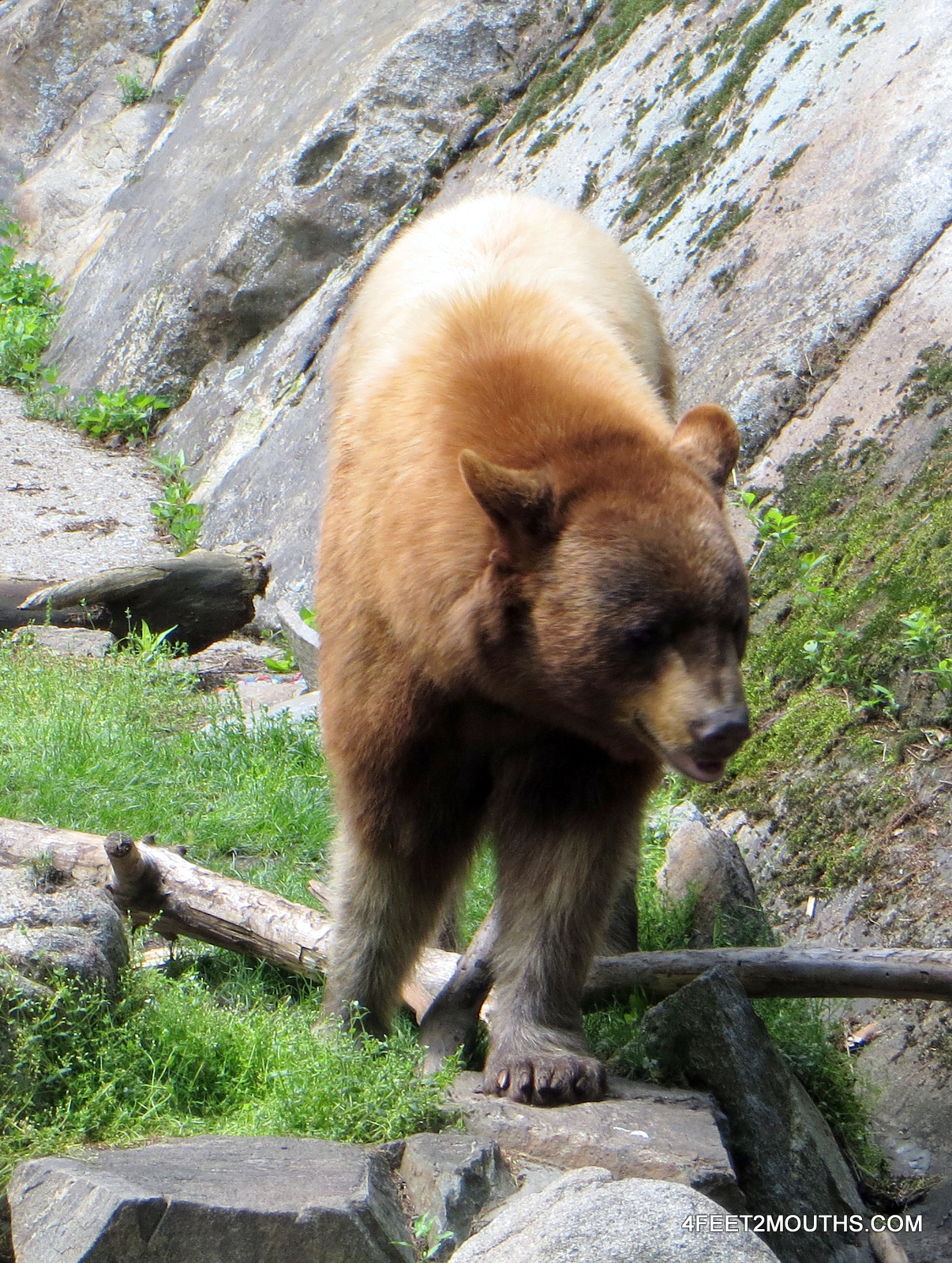
Hiking shadows on South Kaibab Trail

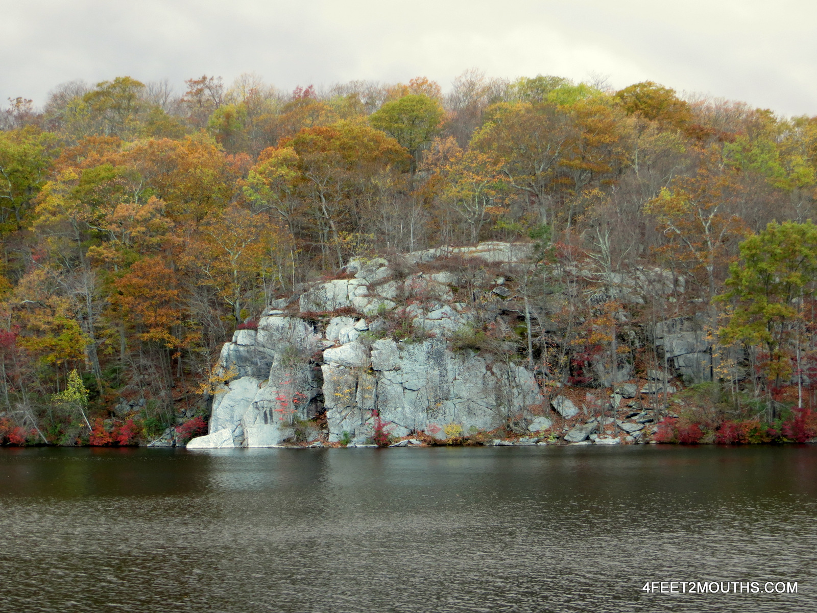
The best way to describe the South Rim of the Grand Canyon in summer is HOT. The heat that collects in the valley billows over the rim in waves of hot air. The dryness creates a landscape that is seemingly bleak and lifeless. But then I when we peer down into the deep abyss, into the alternating colors of red, orange and white, we see the Colorado River. In total this artery to the region channels water for 1,500 miles acting as the lifeblood of a complex ecosystem. Thick pine forests meet the rims edge, and desert cacti cling to the valley sands. The waters were once colored red with silt, but are now blue and cold from dams upstream.

Grand Canyon from Monument Creek vista

We arrived just after dusk and pulled into a car camping spot just outside of the park. We woke at sunrise to go and see our first views of the canyon. We were immediately awestruck by the beauty of the canyon. The colors are bright and omnipresent; slowly the light brightens, our faces become visible and the glow fills the valley. We picked up our first set of permits at the back-country office and we were ready to begin our hike the following morning.

Carmen hiking on the South Kaibab Trail

Skeleton Point on the South Kaibab Trail

We had the afternoon free so we grabbed our water bottles and made our way to the South Kaibab trail. We traversed down the steep switchbacks and made our way deep into the canyon. This trail is exciting with steep cliffs on both sides and stunning views throughout its length. We walked along the ridge line soaking in the afternoon sun. Our final stopping area and snack break was at Skeleton Point, a saddle at the tip of the ridge before the trail breaks off into more switchbacks to the Colorado River. Rejuvenated from a short rest, we turned around and ascended the 2,000ft (600m) back to the trail head. As we climbed our way back up the mountain the sun began to disappear beyond the cliffs. Slowly the grey shadows began to darken and the blackness crept its way up the canyon.  We setup our tent and cooked dinner that night in the darkness of the South Kaibab National Forest.

Nathan making his way to Salt Creek

The sunsets in the Grand Canyon are beautiful, but it is at sunrise that the park becomes a scene of magic and changing light. Our hike into the canyon began early at 5am. We hiked down the switchbacks in the usable twilight of dawn. Slowly the canyon changed shape and color as the planar greys disappeared with a new day’s sun. The sunlight first touches the upper limestone of the rim in every direction. Slowly this bright golden light drips down the cliffs illuminating the entire canyon.

Carmen the morning hiker on Hermit Trail

Perfectly shaped yucca

The shadows disappear, the heat engulfs us and we continue our walk in the full sun. The hike planned was a three day, two night, 30mi (48km) loop starting at Hermit’s Rest and returning from Indian Garden up the Bright Angle Trail. It was going to be very hot in the valley so we tried to get a jump on it. Water was also scarce so we carried one gallon each to safely get to our backcountry campsite with a natural spring.

Monument rock pillar

By 11am we had made it to the campsite at Monument Creek. No one else was there (because it was too hot) so we got the pick of the campground. Our camp overlooked intricate cliffs of vertical red rock. One column of rock, the “monument” of our camp, stood prominently 150ft (45m) in the air in the creek bed.

Granite rapids of the Colorado River

We took a siesta in the shadows of the vertical rock. After 3pm the canyon began to cool down and it was safer to explore and hike around the area. Our camp was on the Tonto formation which is an enormous ledge that wraps around the entire canyon. The Colorado river sits another 600ft below. We walked along the dried out Monument Creek until our voices were drowned out by the roaring Granite Rapids. A small hike upstream and the water was still and frigid enough to make me yelp when I plunged in head first. Refreshed, we made our way back into the depths of the canyon.

Red rock cliffs

Walking from the river out of the canyon is a powerful experience. The dark black gneiss at the water’s edge is two billion years old; the age of the earth is five billion. The history of the world was everywhere around us.  We climbed over boulders and river rock to return to our camp, but we were also climbing back to the future. We walked from a time when volcanoes created the base of the canyon, and then alternating layers of sandstone and limestone as the landscape was created under large oceans hundreds of millions of years ago. Magnificent cliffs towered above us as we walked, but we remained careful of every step spending most of our time watching where we were going.

Three rattlesnakes and a lizard

We encountered three rattle snakes in the first three days of visiting the Grand Canyon. In all cases the snakes were curled up in defense as they had heard us coming. To our benefit we walked with hiking poles that led us along the trails and river banks. With each discovery of a snake, it was fascinating how the colors varied and each was so remarkably camouflaged into its surroundings. A rainbow colored lizard insisted on hanging around our camp, he was plump and bold. He’d stare at us, and, when he knew we were watching he’d start a series of pushups then move a few inches and begin another set of pushups.

Indian Garden on Bright Angel Trail

Textured cliffs of Indian Garden

Our second day of hiking was brutal. The hike itself was mostly flat as we traversed along the Tanto Trail that followed the steady, but exposed rock formation. The challenge was that by 6am we were already walking in the sun, temperatures quickly reached 100 degrees and we had six more miles to go. One step at a time we slowly and carefully made it to Indian Garden. This lush valley had been used for thousands of years for seasonal agriculture by the Havasupai tribes. Today it is filled with non-native cottonwood trees, water-filling stations and many back-country campsites.

View from Plateau Point

Dinner at Plateau Point

For dinner that night we decided to hike out onto the plateau point about a mile and a half from camp. From there we watched the sunset, and cooked up one of our standard back camping meals of sautéed tuna, onions, carrots and garlic over couscous with lemon. We could see the Colorado River from our little perch and quickly the sun faded away leaving us to walk in the dark back to our tarp.

View from Hermit’s Point

Ideally when we backpack, Carmen and I carry a tent. The lower elevations of the Grand Canyon were so hot that we left behind the extra weight and instead slept with only our silk sleeping sacks and the footprint of our tent. In the end it was well worth the 5lb savings, when we were also carrying 8lbs of water. That next morning we awoke again in the darkness to set out on our ascent out of the canyon. By 8am we had climbed 3,500ft (1,050m) and we sat at the Bright Angel trail head, catching our breath, finishing off our morning snacks, and gazing out into the morning sun lit canyon.

Native American building ruins

Indigenous tribes lived throughout the Grand Canyon for millennia. Evidence of their presence is well hidden, but everywhere. Only 5% of the national park has been surveyed and over 4,500 archeological sites have been discovered. It is estimated that there are over 50,000 sites in the park that contain, rock paintings, building ruins, burial sites and agricultural plots. Only the most elementary of this archeology is shown to tourists, but it is possible to bushwhack through the forest and come across, a circle of stones that once built a village, or hand painted pottery that is centuries old. Archeologists have found parrot bones in these areas, which proves that the Indians here traveled and traded with tribes in Central America. In the watchtower that was built on the eastern edge of the park there are some beautiful re-creations of Hopi Indian paintings.

Modern Hopi painting

Our first four days in the Grand Canyon took us to phenomenal vistas, dizzying temperatures and eye-opening history. The south rim is the most popular place to visit for tourists, many of the best lookouts are accessible only a few steps from the public tram. A ten minute walk along any trail and the canyon begins to engulf and encapsulate with spectacular colors and unimaginable verticality. We would hike for hours without seeing anyone and each shadow and niche, each boulder and ledge was only for us to see that day. Very quickly I felt alone, not in loneliness, but more so as an explorer seeing a magical place for the first time. During our hikes we descended into the depths of the canyon, touched the water, traversed the cliffs and climbed back out. We descended into a prehistoric era and climbed back into the present to realize that the Grand Canyon has been one of the most beautiful places on earth for the last five million years.

Post Navigation